122
Stato Pontificio '800
cm.71x85
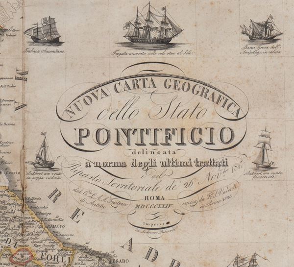
New Geographical Map of the Papal State outlined in accordance with the latest treaties and the Territorial Distribution of 26 November 1817
Large map of the Papal States outlined by the cartographer Trestour of Antibo pursuant to the territorial department of 26 November 1817, engraved by Francesco S. Valenti in 1823, printed and published in Rome in 1824 by Lodovico Riccardi.
In the bottom left panel there is the portrait and in the bottom right corner the heraldic coat of arms of the Duke of Blacas d'Aulps, de Principi di Baux, Peer of France, to whom the card was specifically dedicated. Section with legend and explanation of the signs. Compass rose at the bottom center, with the words "Magnetic sundial for the Papal Coasts"
Beautiful depiction with details of various boats sailing on the Adriatic Sea and the Tyrrhenian Sea.
Measures approximately 71x85 cm. Folds, scattered browning, 5 defects of which the most extensive measure 40x9 mm and 35x9 mm along the longitudinal fold, in general good condition.
Bibliography: Ronca, Sorbini, The Ancient Papers of the Duchy of Spoleto, page. 254.
€ 1.000,00 / 1.200,00
Estimate
€ 600,00
Starting price
Live auction 300
Memorabilia. History & Movie
Palazzo Caetani Lovatelli, tue 28 May 2024
SINGLE SESSION 28/05/2024 Hours 15:00


