424
Eredi Johann Baptist Homann
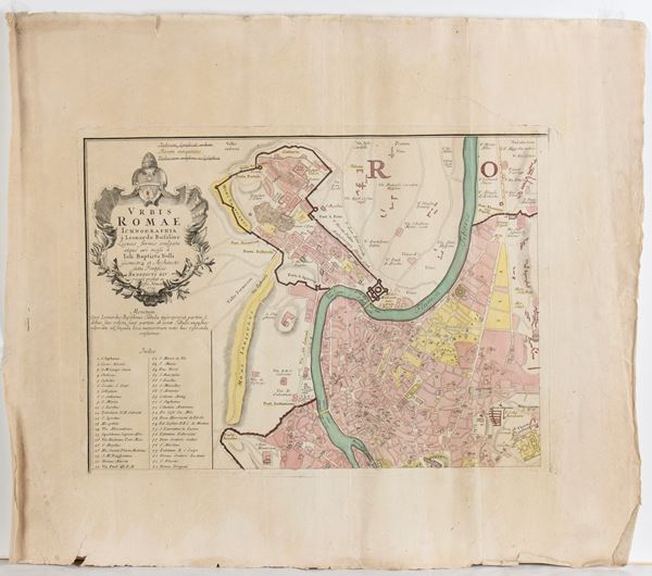
Urbis Romae Ichnographia à Leonardo Bufalino Ligneis formis evulgata atque aeri incisa à Joh. Baptista Nolli Geometra et Architecto sumi Pontificis Benedicti XIV..., 1755
Etching, approx. 365 x 495 mm (each plate); approx. 585 x 675 mm (each sheet). Map of Rome based on the Noli's version of 1748, which elaborates Leonardo Bufalino's important plan of the city of 1551.
Printed from four plates on four separate sheets, yet to be joined, with large margins. Laid paper with watermark. Coeval hand-colouring. Overall, in very good condition, except for some creases and very light browning.
€ 600,00 / 800,00
Estimate
€ 400,00
Starting price
Unsold
Live auction 316
Old and Modern Prints, Drawings and Maps
Palazzo Caetani Lovatelli, thu 14 November 2024
SINGLE SESSION 14/11/2024 Hours 12:00


