490
François Halma (1653 - 1722)
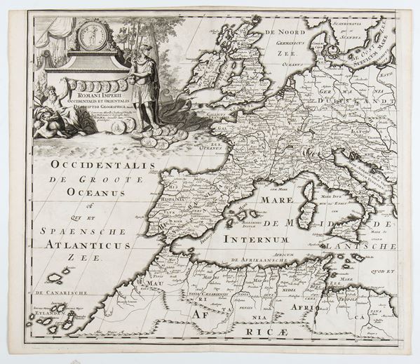
Romani Imperii Occidentalis et Orientalis Decriptio Geographica Auct, 1700 approx.
Printed on two sheets yet to be joined. Engraving and etching, 390 x 452 mm (each sheet). Map of the Roman Empire, after Nicolas Sanson's model, published by Pieter van der Aa.
Very nice copy on laid paper. Two sheets still to be joined, in perfect condition, each with the usual central fold.
€ 400,00 / 800,00
Estimate
€ 200,00
Starting price
Unsold
Live auction 316
Old and Modern Prints, Drawings and Maps
Palazzo Caetani Lovatelli, thu 14 November 2024
SINGLE SESSION 14/11/2024 Hours 12:00


